A Nithsdale Way |
|
This possible Nithsdale Way runs from Criffel on the Solway coast to Wanlockhead, Scotland's highest village, over 5 days. It is currently a work in progress. The intention is to have as little public road, and as little forestry plantations, as possible, and to make a varied walk of seashore and hill, moorland and woodland, and riversides. The going will be on paths and tracks, often with wide views. Click any thumbnail for image gallery. |
| |
|
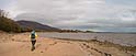
Preliminary section: Rockcliffe and Sandyhills Rockcliffe, Port o' Warren, Sandyhills, Caulkerbush; and then either up Criffel or by coast to Southerness. The initial coast walk above cliffs is excellent, but an onward route onto Criffel has yet to be worked out. This section may be developed and added on later. |
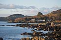 Rockcliffe Bay |
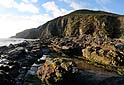 Port o' Warren |
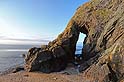 Needle's Eye, near Sandyhills |
 coast path to Sandyhills |
|
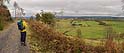
1: Southerness to New Abbey Coastal walking to Carsethorn, roads to Kirkbean. The wooded gorge of Kirkbean Glen and the southern ridge of Criffel. Down to New Abbey. This ascent to Criffel is beautiful, but rough going in tall grass and heather, with some boulders – an alternative for the time being may be to start the route on Criffel summit (ie come up the well built path from Ardwall). |
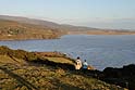
 Southerness shoreline, with Criffel ahead |
 Kirkbean Glen |
 descent from Criffel |
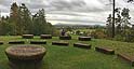
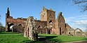 Sweetheart Abbey |
|
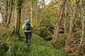
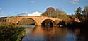
2: New Abbey to Dumfries Shambellie wood (which is mostly plantations, but with some views) and Mabie Forest. Arrive in Dumfries over the historic and beautiful Devorgilla Bridge. |
 Mabie Forest (Red Trail viewpoint) |
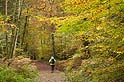 Mabie Forest |
 Nith View trail, Mabie Forest |
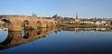 Devorgilla Bridge |
|
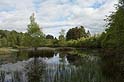
3: Dumfries to Auldgirth The intention is for this section to end at Dunscore, west of the Nith: getting there by way of Cluden Water and Killieleoch Hill. This is still to be explored. A straightforward preliminary version is by the east bank of the Nith, and picturesque Dalswinton Estate, to Auldgirth with its inn. This is almost flat, on good paths throughout, with some wider views at the end. |
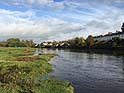 River Nith at Nunholm, on the edge of Dumfries |
 River Nith at Carnshalloch |
 Dalswinton Loch |
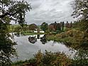
 Journey Garden, Dalswinton Estate |
|
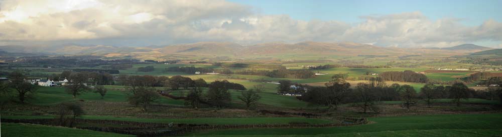
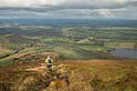
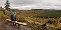
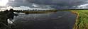
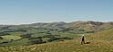
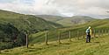
4: Dunscore or Auldgirth to Thornhill The crossing of Kier Hills, a high-level moorland ridge, gives wide views. The exit at its northern end is yet to be determined. From Kier Mill, the route continues along the west bank of the Nith to Thornhill. |
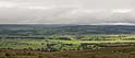 Nithsdale from Kier Hills |
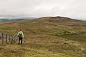 on Kier Hills |
 cairn on Barr Hill |
 Nith Bridge at Thornhill |
|
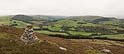
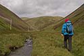
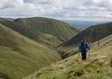
5: Thornhill to Wanlockhead The final section is rather long and strenuous, with almost 1000m of ascent. It leaves Thornhill by wooded pools of Dabton and Morton Lochs, From ruined Morton Castle, head up onto low, grassy hills above Kettleton Reservoir. Pass Durisdeer, to finish up the narrow glen of Enterkin Pass, joining the Southern Upland Way for the final high-level moorland and descent to Wanlockhead. An alternative for the first part of the walk follows the west bank of the Nith to Drumlanrig Castle and its woods, before high farmland and plantations into the Enterkin Pass. This is almost as good, and a bit less strenuous. |
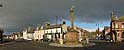 The Cross, Thornhill |
 Lower Morton Loch |
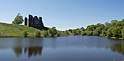 Morton Castle |
 on Morton Mains Hill |
 above Enterkin Burn, heading into Enterkin Pass |
 lower part of Enterkin Pass |
 top of Enterkin Pass |
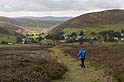 descent to Wanlockhead |
| homepage | books | articles | photos | contact |